Mapplication
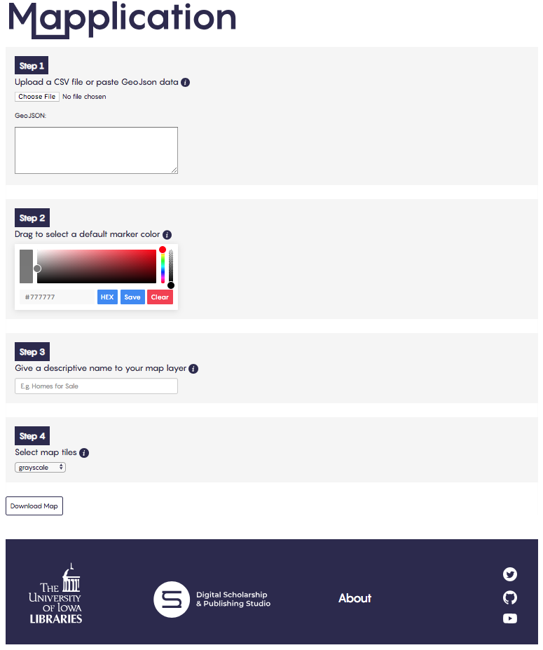
Mapplication is a tool I built with my co-workers (Rob Shepard, Ethan DeGross, and Alyssa Varner) as a way to rapidly prototype maps for researchers and scholars. It accepts a CSV file upload and outputs a leaflet map. It converts the spreadsheet into valid GeoJSON, allows the users to pick a marker color and map layer name, then zips all the necessary files into a convenient download. The purpose of this tool is to allow users a very quick way to visualize their geographic data in a format that can be easily self-hosted. It was presented at the 2018 DLF forum in Las Vegas.
Use the Mapplication tool
Read the Mapplication code